Parts of the Midwest and the Northeast can't catch a break from wintry weather - even though winter hasn't officially started - as a fast-moving low-pressure system moving in Monday from Canada brought more dangerously low temperatures and new snow on the tail of the weekend's major winter storm.
"It's just one after another. It's kind of a parade of snow marching across the country," said Jonathan Erdman, a senior meteorologist at the weather channel.
The "Alberta Clipper" system, named for its origins out of the Canadian province, is accompanied by light snow, strong winds and extremely colder temperatures. Manitowish Waters in northern Wisconsin dropped to 26 degrees below zero early Monday, and similarly bone-chilling conditions were recorded across Wisconsin, Minnesota and Michigan.
Lows are expected to stay stuck in that zone at least through Thursday, the National Weather Service said.
A Wisconsin man was being treated for hypothermia after he was stranded when he rammed his snowmobile into a lakefront ice shelf in Calumet County, NBC station WGBA of Green Bay reported.
A state plane had to be called out to help find the 33-year-old man as ground-based rescue crews were nearly blinded by white-out snow Sunday afternoon.
The icebox that is the Upper Midwest is turned down to its lowest setting in more than 40 years, the National Weather Service said. The average high for the week of Dec. 6 in many parts of Minnesota was 6 degrees - the lowest since 1972, when gas cost 36 cents a gallon.
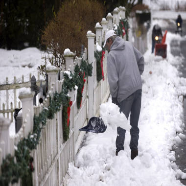
Steven Senne / AP
Overnight lows dropped well below zero, to temperatures that can freeze exposed skin in as little as five minutes, according to the Mayo Clinic.
Parts of Ohio were shivering in high temperatures 15 degrees below normal, in the lower 20s. The Weather Channel forecast light to moderate snow Monday in the Lower Midwest and Tuesday in the Northeast, with accumulations of less than 5 inches in most highly populated areas affected by the Clipper.
Milwaukee and Chicago were forecast to receive "pretty minor" bands of snow Monday, within the 1- to 3-inch range.
New York City, fresh off 5 inches of snow Saturday, was predicted to see another couple of inches Tuesday, with up to 5 inches in parts of Boston. Coastal and eastern Maine were expected to see the heaviest snowfall.
Get the latest weather news and your local forecastErdman said the additional snow would continue to affect roads and commutes. In most of the areas hit by the weekend snowstorm, temperatures Monday were expected to remain below freezing but still high enough for salt to diminish icy conditions on roads before the new system moved in.
But in hard-hit areas like Upstate New York and northern New England, temperatures Monday were in the teens or the single digits.
"There's not much salt can do there," Erdman said.
"The impact in the Northeast will be felt during tomorrow morning's rush hour," he said, adding that parts of Philadelphia and Pittsburgh and most of New York's five boroughs would see falling snow and slick travel conditions Tuesday morning.
Temperatures were expected to keep dropping through the afternoon into the night in New Hampshire, Maine and Vermont, with coastal areas dipping below well zero overnight.
The bigger problem is strong winds that will create dangerously low wind-chill conditions, said Jim Brown of the National Weather Service office in Gray, Maine. For the second straight night, winds will make it feel like 30 to 40 degrees below zero in the mountains after wind chills that plummeted as low as minus-57 Sunday night in Mount Washington, N.H.
The latest storm comes on the heels of a weekend bout that dumped on the Northeast, leaving more than a foot of snow in some places.
Not everyone was complaining. Sixteen inches of snow fell on Okemo Mountain Resort in Ludlow, Vt., allowing the ski resort to open 91 trails. Most New England resorts are open for skiing and riding 10 days before Christmas.
"We have been watching [the forecast] since people first started talking about it on Monday or Tuesday," said Ethan Austin, a spokesman for the Sugarloaf Ski Resort in Carrabassett Valley, Maine. "We're pretty psyched."
Related:This story was originally published on
No comments:
Post a Comment